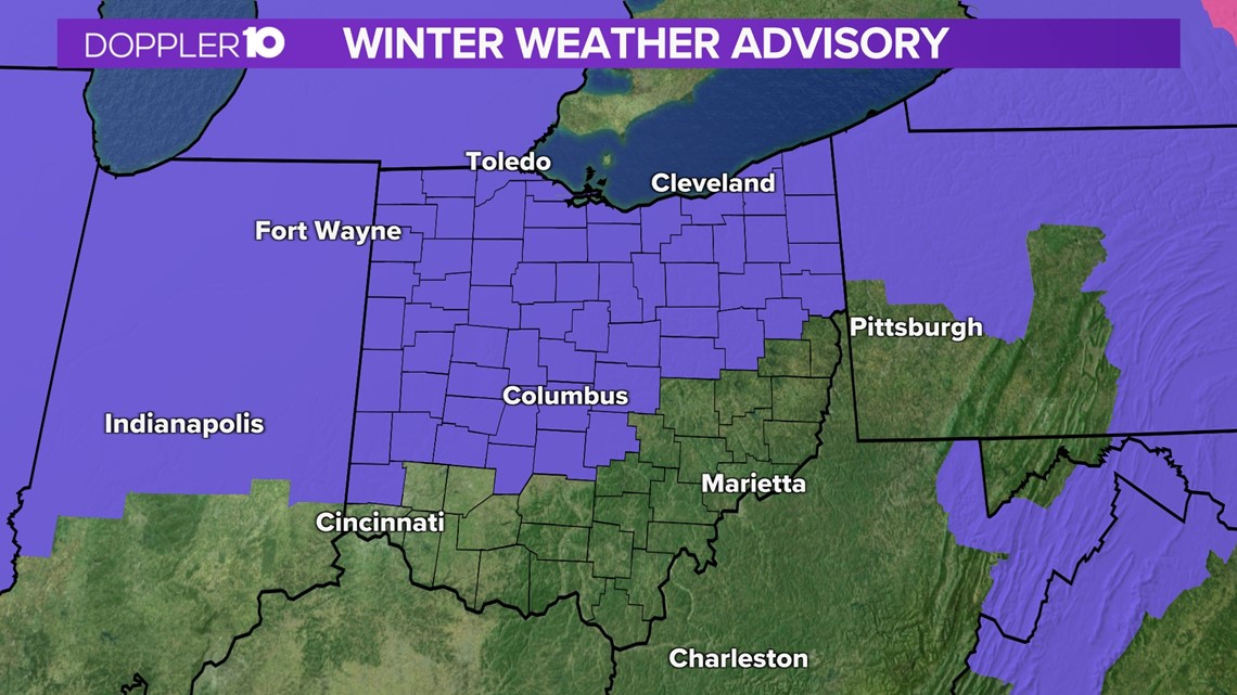
COLUMBUS, Ohio — The worst of our weather system has moved out of the area, but some slick spots could remain, especially in the north. After that, we’ll enter a quieter pattern with another First Alert day possibly late next week. It’s still too early to talk specifics on that, though.

Areas south of I-70 are expecting to mainly see rain which will just add to the flooding issues we have been dealing with.
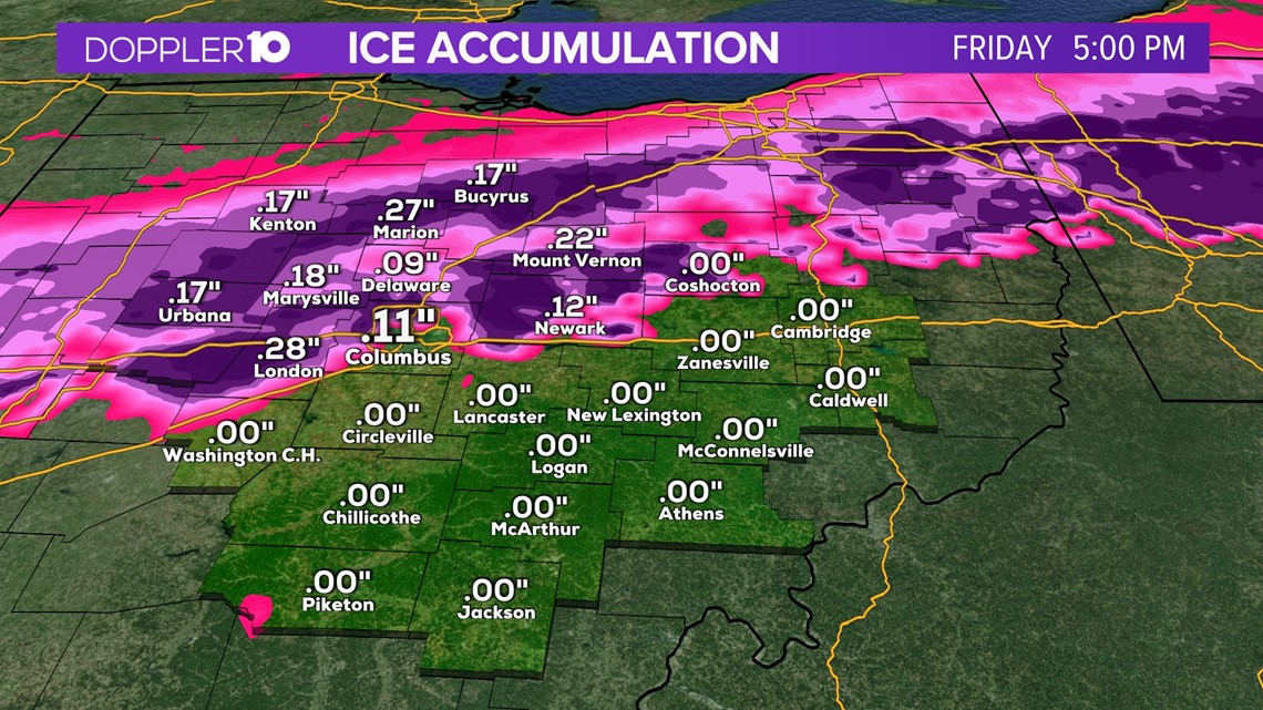
Around the I-70 corridor, is where the forecast will be difficult. Rain will transition to freezing rain and sleet during the late evening.
Weather Resources: Interactive Radar | Watches & Warnings | Closings & Delays
North of I-70 is where we are expecting to see the greatest impacts in terms of ice. Some areas could see 0.10”-0.20” of accumulation.

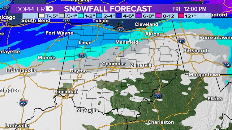
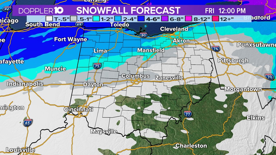
Snow will mainly be a problem for areas in northern Ohio where 1-3” of snow is expected, with more the farther north you go in Ohio.

Precipitation will come to an end before sunrise tomorrow morning but the new problem will be any wet spots refreezing as temperatures drop below freezing tonight.
Slick spots are likely for the early morning Friday but we should see improvements by Friday late morning.
Weather Resources: Interactive Radar | Watches & Warnings | Closings & Delays