It's August and so far, we've only had two named storms for this year's hurricane season.
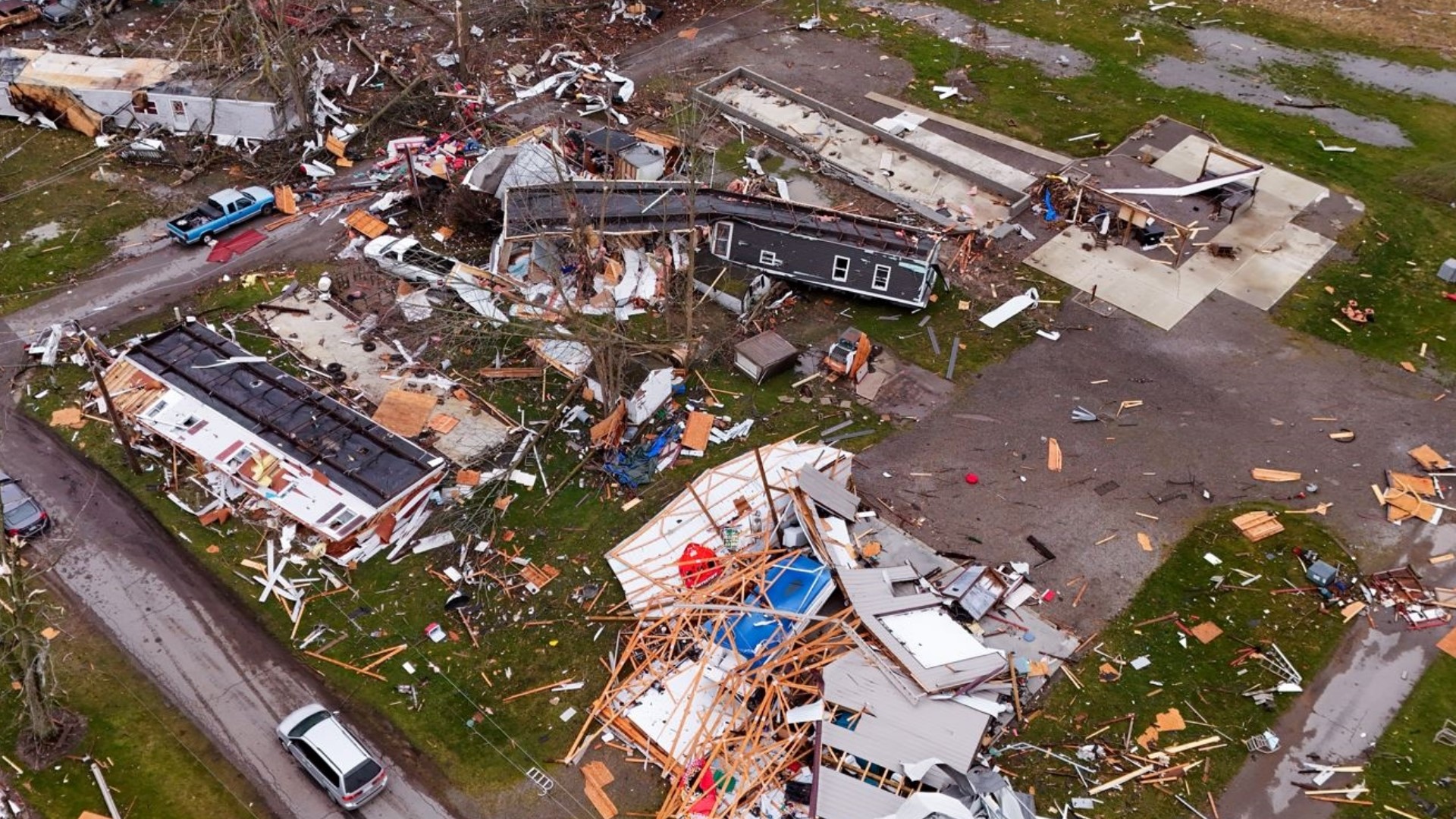
Subtropical Storm Andrea was an out of season, fish storm that lasted less than 24 hours in the middle of the Atlantic. The second storm, Hurricane Barry, made some noise along the Gulf Coast, bringing heavy rain, flash flooding and storm surge across much of the Louisiana Coast.
Since that storm, which occurred July 11 through July 15, there has been a lull/break in the tropical storm activity.
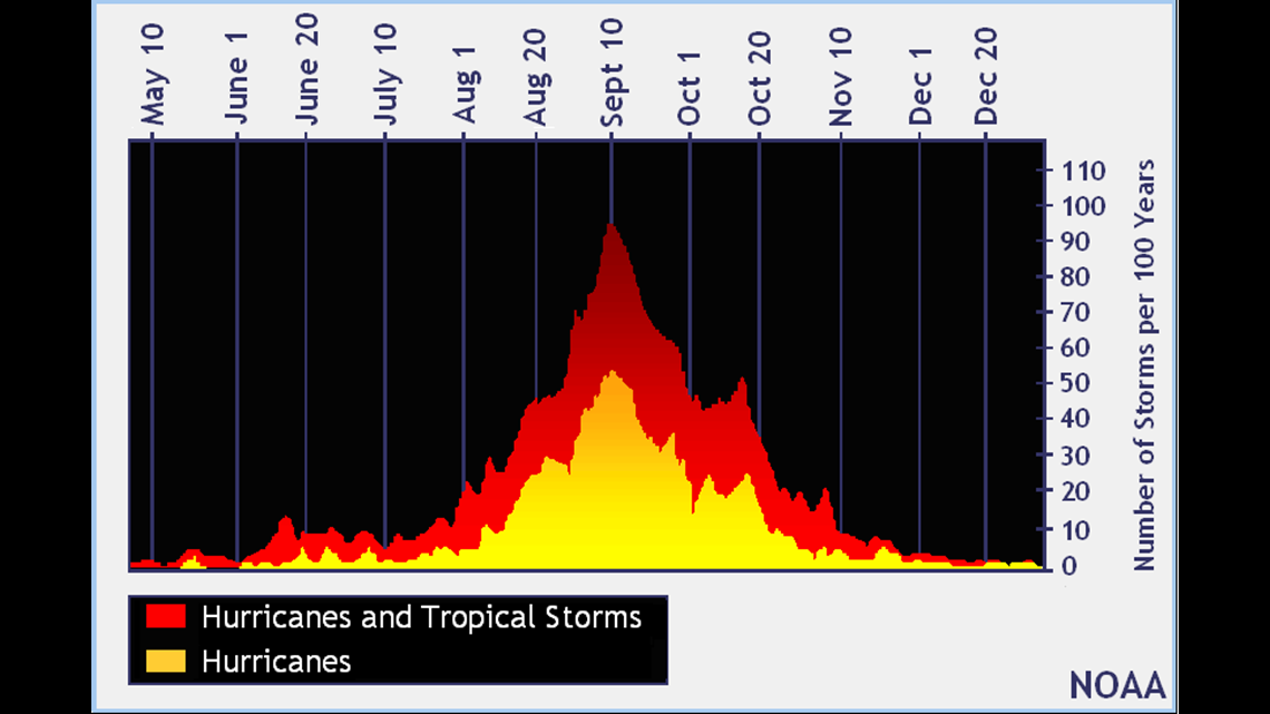
Enjoy the calm waters because, statistically speaking, we're not near the peak of hurricane season.

There are a lot of factors that contribute to the formation of tropical systems, some of which take a while to develop. Let's go over some of the factors that are playing into this current situation.
One of the things that contribute that you have probably heard before is El Nino. El Nino (La Nina) is the warm (cool) phase of a climate pattern across the tropical Pacific.
The pattern can shift back and forth irregularly every two to seven years. These shifts cause large scale air movements, triggering a domino effect of global weather side effects.

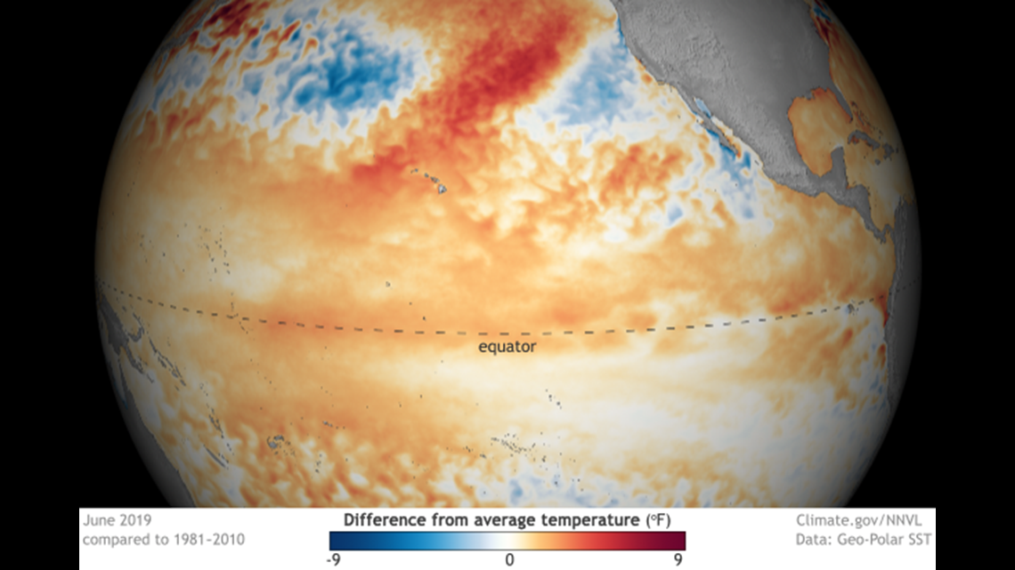
During the Atlantic Hurricane season, El Nino can have a negative influence on tropical storm development, specifically in the Atlantic. The opposite happens in the Pacific where there is less vertical wind shear to impact storm development.


Tropical storms like warm waters but need weak winds aloft in order to develop further vertically. El Nino typically creates wind shear and stable air in the tropics, which goes against tropical storm development. Another big contributing factor is the placement of the Jet Stream or the winds located high in the atmosphere that steer large scale weather patterns.
During summer, we typically see a shift in the Jet Stream going north, which creates a warmer environment for us in the Great Lakes.

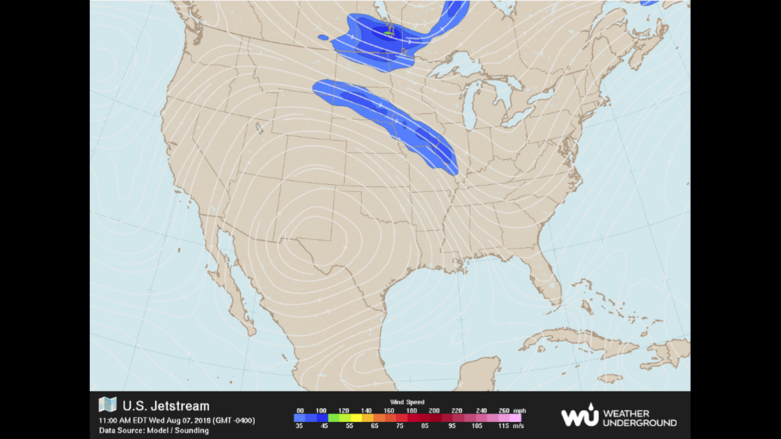
This recent Jet Stream plot over the United States shows the faster converging winds aloft in the northern United States. When we see a southerly shift in the Jet Stream, we sometimes see pieces of energy along the jet get drawn into different environments (a.k.a the Gulf of Mexico) and begin to see storms develop.
Warm waters of the tropics region also aid in storm development, which are the warmest near the peak of the season.
So we have El Nino, the Jet Stream, wind shear, stable air and the waters of the tropics region, but there's one more big contributor that you may not be expecting: dust. That's right, dust.
Saharian dust traveling thousands of miles off the coast of Africa due to the easterly trade winds near the equator.


The dust (aerosols) that blast across the ocean actually inhibit storm development from drying the air around it. When you have a dry atmosphere, you limit the amount of moisture, which then leads to a lack of thunderstorm development and furthermore tropical storm development.
So, does this mean the rest of the season will be quiet, considering all the factors listed above? No. While a lot of variables are going against storm develop right now, again, the peak of the season is still yet to come and typically we see more favorable variables (less wind shear, warmer waters and less dust) come together.
The current El Nino is also expected to weaken and turn into a neutral phase, which should also help with tropical storm development later this year.


The 2019 Atlantic Hurricane season outlook is still expecting a near-normal season, with 4-8 Hurricanes, 2-4 of which could be major hurricanes.