
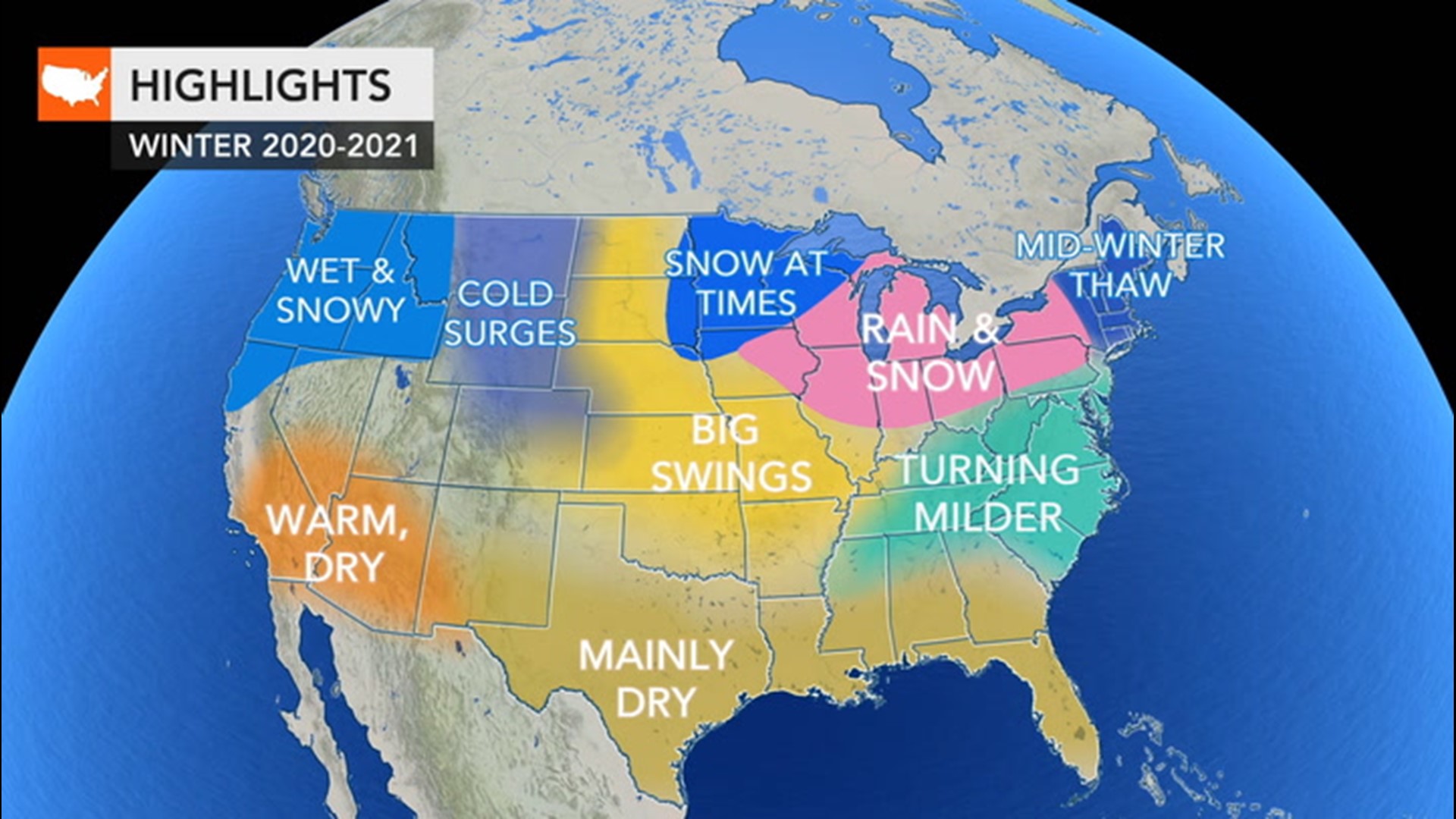
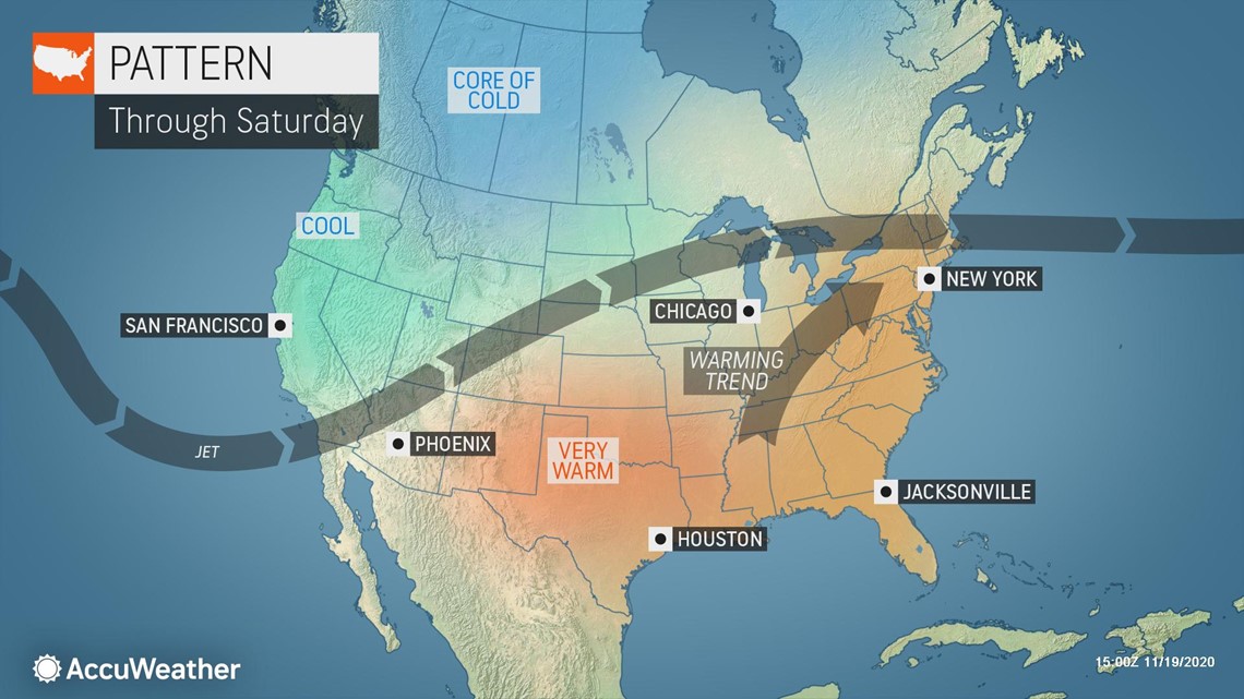
A warm stretch of weather is in the offing for the Northeast as the week winds down, but residents shouldn't get used to the above-normal temperatures. AccuWeather forecasters are tracking a new storm developing over the central U.S. that is expected to bring wet and chilly weather into the beginning of next week.
This stretch of warm conditions will be brought to an end by a storm system that will start to emerge over the mid-Mississippi Valley on Saturday.

By Saturday night, pockets of heavier rainfall are expected to develop from Kansas and Oklahoma to Illinois and Indiana. While the heaviest rain could lead to some ponding on roads that are low-lying or have poor drainage, much of the area will welcome the rainfall after a relatively dry pattern.
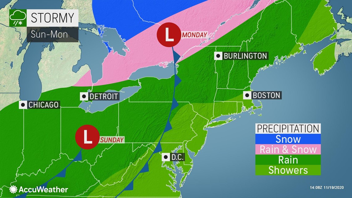
This rain is not expected to linger over the area for long as the storm tracks in a northeast direction on Sunday, spreading rainfall across the Ohio Valley and into the Northeast.
As the heaviest rain arrives in the Northeast on Sunday night, conditions will begin to improve across the Ohio and Mississippi valleys.
Rainfall will linger over New England into early Monday before the storm moves away toward Atlantic Canada.

"This storm is forecast to move quickly across the Northeast; this will help to keep rainfall totals down," stated AccuWeather Meteorologist Nicole LoBiondo.
From Saturday to Monday, rainfall totals of 0.50-1 inch will be common from Kansas to Maine. Some pockets of 1-2 inches will be possible in higher elevations or where rain falls for an extended period of time.
Localized flooding and reduced visibility in heavier downpours may not be the only concern with this storm. Colder air on the northern side of the system can cause some wet snowflakes to mix with rain as precipitation pushes north on Sunday and Monday.
AccuWeather forecasters will also be keeping an eye on the potential for snow on the backside of the storm.
"If the storm follows a track farther south, it can puller colder air southward and allow snow to mix with rain across the Adirondack, Green and White mountains," added LoBiondo.
Any snow that falls across northern New England is not expected to accumulate on roadways due to the warm surge expected through the end of the week. The ground is slower to lose heat even as air temperatures plummet.
Any motorists on interstates 84, 87, 88, 89, 90, 91 and 95 will need to be prepared for slippery travel conditions late Monday night and into Tuesday morning in New England where low temperatures are expected to drop below freezing (32 degrees Fahrenheit).
Slippery spots will be most likely on bridges and overpasses as well as any roads and sidewalks that spend most of the day in the shade.
Chilly conditions are forecast to linger into Tuesday as forecasters begin to monitor the next storm system that could interrupt any plans to spend time socially distancing outdoors this Thanksgiving.