Doppler 10 Weather Resources: Interactive Radar | Live Radar | Weather Warnings | Updated Forecast
LIVE: 10TV's Jeff Booth is tracking what central Ohio can expect this evening.
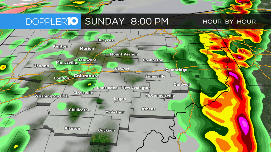
6:44 p.m. Update: Severe Thunderstorm Warning for Ashtabula County until 8:00 p.m.
6:36 p.m. Update: Severe Thunderstorm Warning for Ashland, Knox, Morrow and Richland County until 7:30 p.m. Severe Thunderstorm Warning for Fairfield, Guernsey and Licking counties until 7:15 p.m.
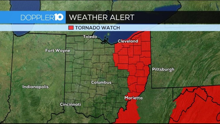
6:24 p.m. Update: The Tornado Watch has been scaled back from central Ohio, leaving most of the focus now to the eastern part of the state.
5:39 p.m. Update: Severe Thunderstorm Warning for Athens, Morgan and Vinton County until 6 p.m.
5:20 p.m. Update: Severe Thunderstorm Warning for Coshocton, Guernsey and Muskingum County until 6:00 p.m.
5:00 p.m. Update: Tornado Warning for Ashland and Richland County until 5:45 p.m.
4:54 p.m. Update: Severe Thunderstorm Warning for Coshocton County until 5:30 p.m.
4:40 p.m. Update: Tornado Warning for Richland County until 5:30 p.m. Other earlier tornado warnings except for Crawford County have been canceled.
4:27 p.m. Update: Severe Thunderstorm Warning for Fairfield and Hocking County until 5:15 p.m.
4:25 p.m. Update: Severe Thunderstorm Warning for Jackson, Vinton, Hocking, Pickaway, Pike, Ross counties until 5 p.m.
4:15 p.m. Update: Tornado Warning for Crawford, Marion, Morrow and Wyandot County until 5:00 p.m.
4:00 p.m. Update: Severe Thunderstorm Warning for Crawford, Marion and Wyandot County until 5:00 p.m.
3:40 p.m. Update: A Severe Thunderstorm Warning has been issued for Champaign, Logan and Union counties until 4 p.m.
3:20 Update: A Tornado Warning has been issued for Clark and Champaign counties until 3:45 p.m.
___
2:30 Update: A Tornado Watch has been issued for for Athens, Champaign, Clark, Delaware, Fairfield, Fayette, Franklin, Greene, Hocking, Jackson, Licking, Madison, Morgan, Perry, Pickaway, Pike, Ross, Scioto, Union, Vinton and Washington County until 9:00 p.m.
____
Original Report: Tracking severe weather moving through central Ohio | April 14, 2019
There is potential for severe weather in central Ohio today.
The NOAA National Weather Service Storm Prediction Center has parts of the area under an Enhanced Risk for stronger storms.
Right now the biggest threat for central Ohio is damaging winds but some hail and possibly an isolated tornado (likely a spin-up along a line of storms) cannot be ruled out.
Rain has stopped across most of the state but that is not good news. Clouds will break this afternoon, allowing for the sun to heat things up, creating more fuel for storms to ignite through this evening.
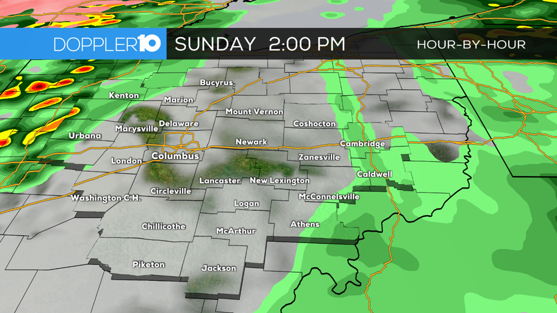
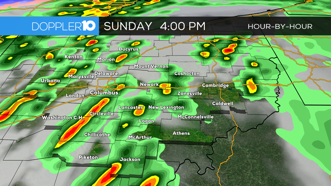
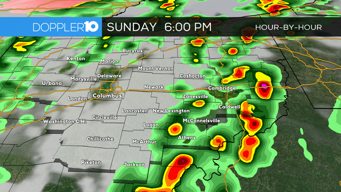
As of Sunday 12:30 p.m., it looks like the best chance for any stronger storms will likely be in the 2 p.m. to 8 p.m. time frame across the state, with much of central Ohio in the 3 p.m. to 7 p.m. time frame. Below is a compilation of the latest high resolution models suggesting how storms could develop through this afternoon. While this will not give the precise location of each individual storm, it paints a broad picture of how these storms will quickly fire up and then push east through this evening.


---
SEVERE WEATHER SAFETY GUIDE
DIFFERENCES BETWEEN WATCHES & WARNINGS
Watch
A Watch indicates the possibility of severe weather in a relatively broad area. For instance, a tornado watch means conditions are favorable for the development of tornadoes. Go about your normal routines, but watch for threatening weather.
Warning
A Warning is issued when severe weather is actually occurring. For instance, a tornado warning means a tornado has actually been sighted or has been indicated by radar. The warning usually encompasses a relatively small geographic area. If a warning is issued for the area in which you live, take cover immediately!
---
TORNADOES AREN'T THE ONLY REASON TO STAY ALERT
Strong Winds
Strong winds of 55 mph or more can cause significant damage even though no tornado is present. "Downbursts" are columns of air that slam to the earth and spread high winds in many directions. Downbursts can be just as damaging as tornadoes; if such conditions are present, take the same precautions as you would for a tornado.
Lightning
Lightning claims more lives every year than tornadoes. When lightning is a threat, stay indoors and don't use electrical appliances. If you're caught outside, keep a safe distance from tall objects, and try to stay lower than anything nearby. A safe distance from a tree is twice its height.
---
TAKING COVER
Storms producing tornadoes in Ohio often approach from the southwest. They can travel at speeds up to 70 miles per hour and contain winds estimated at over 200 miles per hour.
Sometimes an approaching tornado will sound like the roar of a train or airplane. If you see or hear a tornado, take cover immediately. Seek shelter inside, preferably below ground level. Do not waste time opening windows; tornado-force winds will "open" the windows well before the pressure difference can cause any structural damage. Above all, protect your head and lie flat.
At Home
Get away from windows, doors and outside walls. Go to the basement. If you have no basement, go to a first floor bathroom, closet or room at the center of the house. If possible, get under heavy furniture and cover your head with blankets or pillows.
At School
Go the lowest floor or basement. Go to small interior rooms or hallways. Stay away from windows and avoid auditoriums, gyms and other areas with wide, free-span roofs.
In Public Buildings
Go immediately to the designated shelter area or to an interior hallway or small room on the lowest level. Stay away from windows. Do not use elevators. Do not go to your car.