

COLUMBUS, Ohio — The National Weather Service released preliminary reports of the nine tornadoes that touched down in Ohio early Wednesday morning.
The weather agency reported that three of the tornadoes were EF0s, three were EF1s and the other three tornadoes were EF2s.
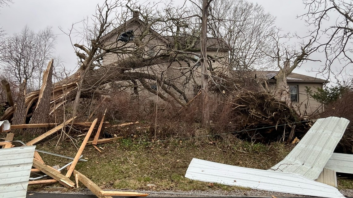
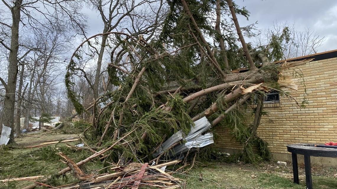
No injuries were reported, but multiple homes were damaged or destroyed throughout the region.
Franklin/Licking County EF2 tornado
NWS says the tornado began in the area of Havens Corners Road and strengthened as it approached McOwen Road. It weakened a bit as it entered Licking County, but still had enough strength to damage trees and other structures in its path. The tornado dissipated in the town of Jersey.
The tornado was on the ground from 5:49 a.m. to 6:03 a.m. for 14 miles, max speeds were 120 mph and its maximum width was 300 yards.

Hilliard EF1 tornado
Preliminary reports from NWS say a weak tornado developed in the area of Alton and Darby Creek Road, moving along the north side of Roberts Road and through portions of Hilliard. A home on Hilliard-Rome Road lost its roof and another home on Westbreeze Drive sustained damage.
The tornado dissolved as it approached Interstate 270.
The tornado was on the ground from 5:56 a.m. to 5:59 a.m. for just over two miles with wind speeds up to 110 mph. It was also about 200 yards wide.
London EF1 tornado
The NWS says the tornado was on the ground for eight miles and was 250 yards wide at one point. It developed near state Route 665 and strengthened as it crossed Spring Valley Road and Glade Run Road, peaking in intensity as it crossed Wilson Road. The tornado weakened and dissipated at Olmstead Road, just south of West Jefferson.


Monroe County EF2 tornado
The NWS report says the tornado in Monroe County in eastern Ohio was rated as an EF2 with wind speeds around 120 mph. The tornado touched down for a total of four minutes, from 7:22 a.m. to 7:26 a.m. It traveled 3.8 miles and was 200 yards wide.
Springfield EF2 tornado
Reports from NWS say the tornado touched down near Shawnee High School on Selma Pike and strengthened as it moved northeast. The stormed reached the EF2 category along Ridge Road where three homes had their roofs blown off.
After this, there was intermittent EF1 and EF2 damage where about a dozen barns and outbuildings were destroyed. The tornado traveled into Madison County, but the survey team wasn't able to complete the track of the tornado because some roads were still impassable.

The tornado was on the ground for an estimated 18 miles and it started at 4:52 a.m. with max wind speeds of 120 mph. The width of the tornado was about 500 yards.
Riverside EF1 tornado
The NWS says most of the reportable damage was observed in Green County, mostly at Wright-Patterson Air Force Base where a restoration hangar had structural damage. Some planes that were in the process of being restored were damaged due to flying debris.


Some homes east of WPAFB were damaged, mostly with shingles being ripped off roofs. The survey team estimates the tornado dissolved near Wright State University.
The tornado was on the ground from 4:37 a.m. to 4:41 a.m. for 2.4 miles with max wind speeds of 100 mph. The width of the tornado was about 200 yards.
Darbydale EF0 tornado
The NWS report confirmed the EF0 tornado just west of Darbydale in Franklin County. The first known damage occurred near Biggert Road and London Groveport Road. There was observed tree and roof damage. The tornado was on the ground from 5:28 a.m. to 5:29 a.m. and traveled half a mile with max wind speeds of 70 mph. The width of the tornado was around 60 yards.
Groveport EF0 tornado
Reports from NWS say the tornado likely began near the Walnut Woods Metro Park area and dissipated on the north side of Groveport, west of U.S. 33. Damage consisted of snapped and uprooted trees and light structure damage. The tornado was on the ground from 5:48 a.m. to 5:52 a.m. and traveled 4.4 miles with max wind speeds of 75 mph. The width of the tornado was around 50 yards.
Harrisburg EF0 tornado
NWS said the EF0 tornado that began in Harrisburg in Pickaway County started south of Carson Road and ended south of Harrisburg. Damage was observed to trees along Carson Road and on the southwest side of Harrisburg. There was also some roof damage to some homes. The tornado was on the ground from 5:29 a.m. to 5:32 a.m. and traveled 2.2 miles with max wind speeds of 70 mph. The width of the tornado was around 80 yards.