Winter's first polar vortex blast hits the Upper Midwest and Great Lakes this week with temperatures plunging below zero.
Lows here in Ohio will drop into the single digits with high temperatures on Thursday forecast to be 25 degrees below average.
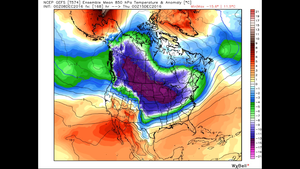
Meteorologists have been comparing weather maps and forecast models for days seeing similarities with the Polar Vortex that developed in January 2014. The southward shift then brought the coldest temperatures in two decades.
The Polar Vortex is a term used to describe an extremely cold air mass over the Arctic. The jet stream (a fast river of high winds) typically keeps these frigid temperatures near the poles. This week's weather pattern will cause a piece of the Polar Vortex to shift south. To put it another way, it's as if the freezer door in your house has been left open and the cold air is spilling out.
The coldest air this week will be centered over the Dakotas. Overnight lows will drop to -15 with wind chill readings between 30-40 below zero. Ohio will wake up Thursday and Friday to temperatures between 0-5 above with wind chills dropping to -15.
Weather Resources: Interactive Radar | Extended Forecast | Live Radar