

As Fay lifts northward with its drenching downpours into Atlantic Canada this weekend, a period of temperate conditions with shower and thunderstorm activity is forecast to precede a surge of heat for the coming week.
While Fay will continue to cause urban and flash flood issues into Saturday over parts of eastern New York state and New England, its rainfall will help to quench the drought conditions that have been building thus far this summer in the region.
"In addition to Fay's moisture, which will avoid the central Appalachians and eastern Great Lakes area, a non-tropical storm system from the Midwest will pivot into the Northeast this weekend to early next week," said AccuWeather Senior Meteorologist Brett Anderson.

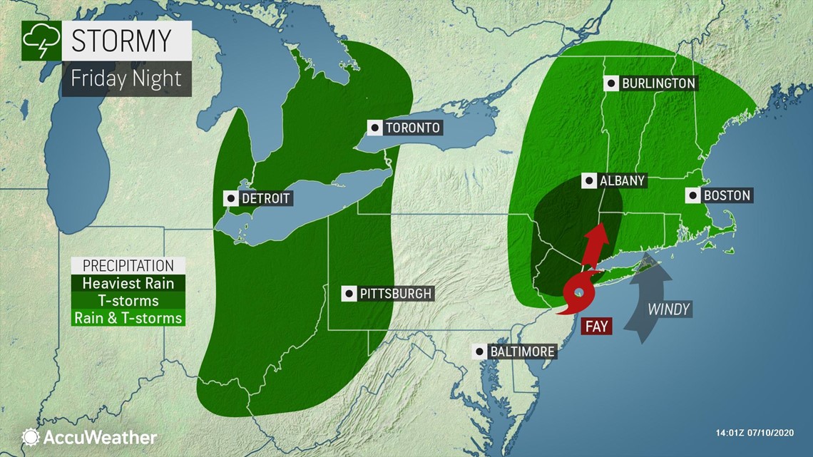
"This moisture, in the form of drenching showers and locally gusty thunderstorms, has the potential to bring some rain to most areas missed by Fay and is likely to overlap moisture from the tropical system as well," Anderson explained.

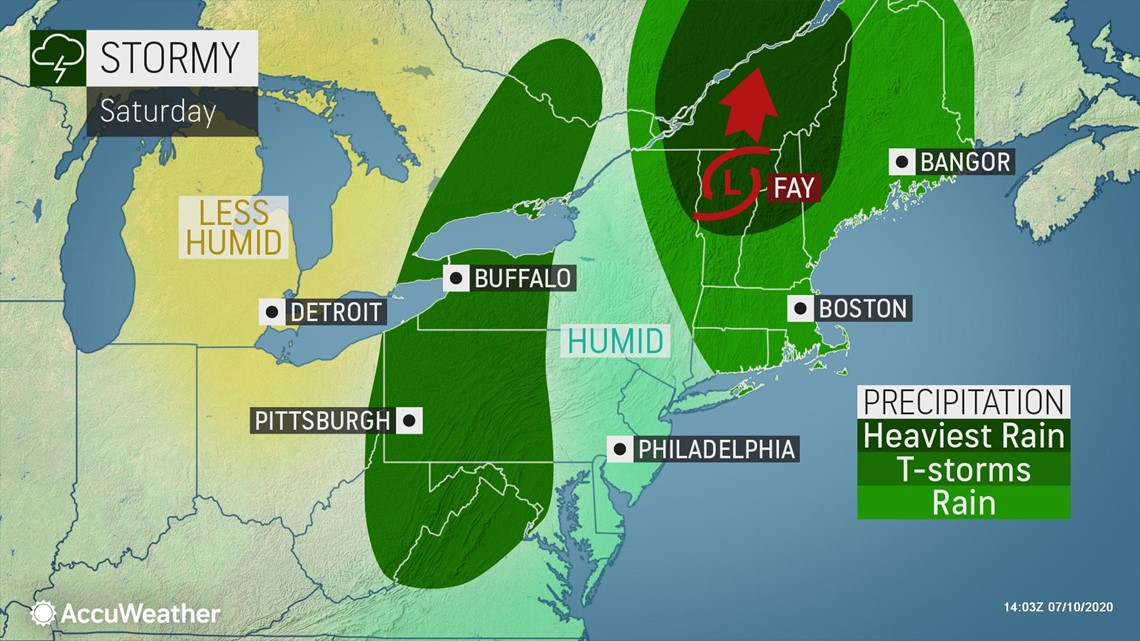
Most of this new rainfall, on the order of 0.75 of an inch to 1.50 inches, is forecast to fall on the eastern part of the Ohio Valley, western slopes of the Appalachians and part of the eastern Great Lakes region. Local rainfall amounts can approach 3 inches, which could be enough to trigger isolated urban and small stream flash flooding.
Areas such as much of Virginia, Maryland and perhaps parts of central Pennsylvania and New York state that dodged Fay's rainfall may be largely missed by this additional rain as well.
As this feature from the Midwest swings in, a slight southward dip in the jet stream will tend to cap daytime temperatures to close to seasonable levels. Highs in most locations will be in the 70s and 80s F from this weekend through Tuesday of the coming week.

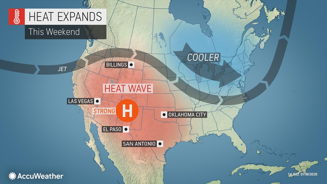
Following the temperate conditions in the Northeast early next week, some of the heat making headlines over the Southwest is expected to lunge eastward later next week.

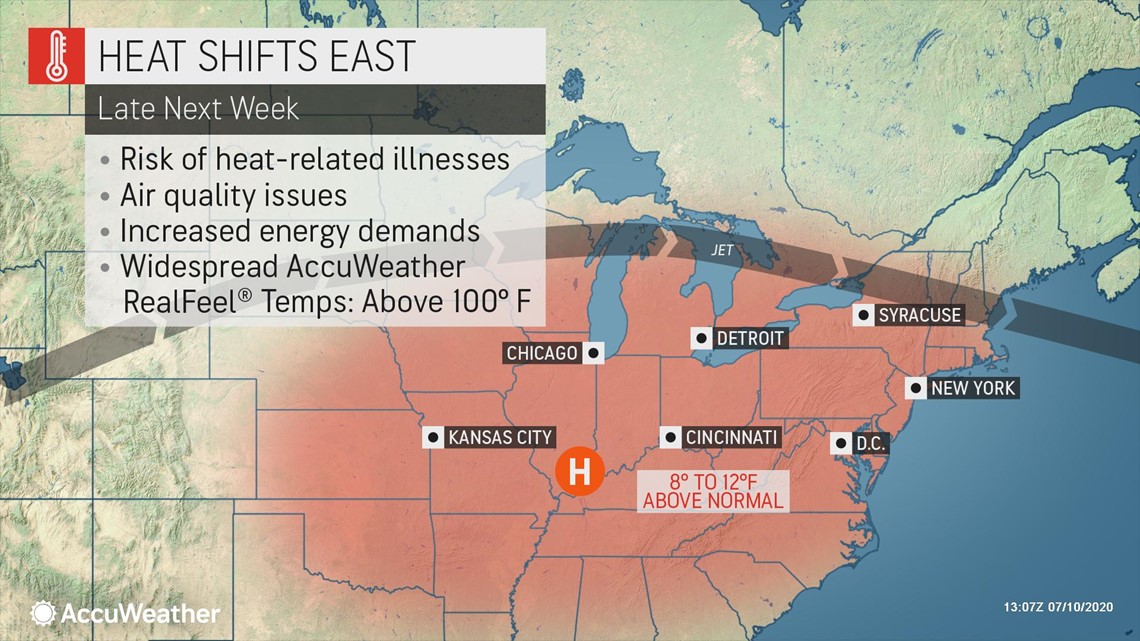
"While the heat for late next week does not look to be quite as extreme as feared from a few days ago, it is still going to get quite hot over a broad area of the Midwest and Northeast during the latter part of next week," AccuWeather Senior Meteorologist Bill Deger stated.
Widespread highs in the upper 80s to the middle 90s are anticipated during the second half of next week. There is the potential for temperatures to reach the highest levels of the summer so far in part of the Northeast.
Some cities that have a chance at topping their high-temperature mark for the summer so far include Cleveland, Pittsburgh and New York City. Both Cleveland and Pittsburgh have topped out at 94 while New York City has peaked at 96.
As the heat surges in the Northeast, it will extend from the southern and central Plains through the Midwest and into much of the South as well. Such a vast area of heat all at the same time could put a strain on power companies to keep up with demand.
However, exactly how hot it gets from location to location will depend on a few factors.
The main issue will be cloud cover versus sunshine, how soon thunderstorms erupt and the extent of the rainfall and how wet soil conditions are.
Where the soil is dry in the same areas that manage to miss rainfall in the coming days will tend to behave more like a desert. These dry spots could have high temperatures that overachieve forecast levels. Meanwhile, some spots where the ground is already wet may struggle to top 90 particularly if clouds linger and additional thunderstorms visit.
In wet soil conditions, more of the sun's energy is used up evaporating moisture from the ground and less is available to heat the ground and the air just above it.