
An extreme drought has covered much of Northern California over the past few months and unfortunately, the only change to the pattern through this weekend will be a couple of opportunities for high winds, which will further enhance the fire danger.
"Gusty winds, dry air and continued drought will combine to create elevated fire conditions across Northern California into Friday," said AccuWeather Meteorologist Renee Duff. "Any ongoing blazes that have yet to be contained could grow in size in the windy weather, and new blazes that spark can spread rapidly."
The first of two primary wind events is expected to reach its peak on Thursday morning.
"The culmination of this event will occur on Thursday, when the offshore winds will be the strongest. Winds could gust between 50-60 mph down some of the northeast- to southwest-oriented passes Thursday morning," said AccuWeather Senior Meteorologist Dave Houk.

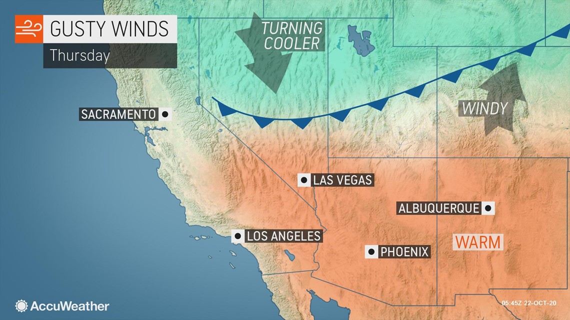
As cold air and snow is occurring in the northern Rocky Mountains, the only effect farther south will be the continuation of dry weather and strong winds.

"Fire dangers will not just be limited to Northern California as dry, gusty winds are expected across Utah, Colorado and New Mexico as well. This means that erratic fire behavior is possible for crews battling the Cameron Peak Fire and East Troublesome fires in Colorado," Duff said.
Given the fire risk, red flag warnings are in effect for portions of several states.
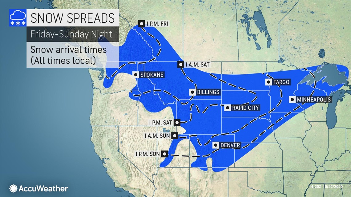
The second of the two wind events may be stronger.
"Winds are forecast to ease a bit late Friday, but yet another wind event is expected over the weekend, and this one may be more significant," Duff said.
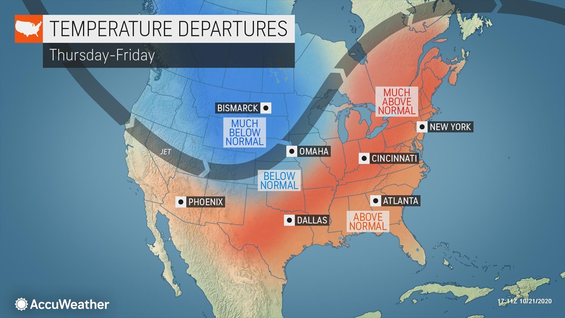
Yet another snowstorm will take place in the northern Rockies and northern Plains this weekend. This snow will provide needed precipitation in Colorado but little, if any, precipitation west of Colorado.

In the wake of the snow, a strong area of high pressure will move southward from Canada into northern Montana. At the same time, there will be a dip in the jet stream that will dive southward into California. The position of the high pressure combined with the energy moving through the Golden State will create strong offshore winds.

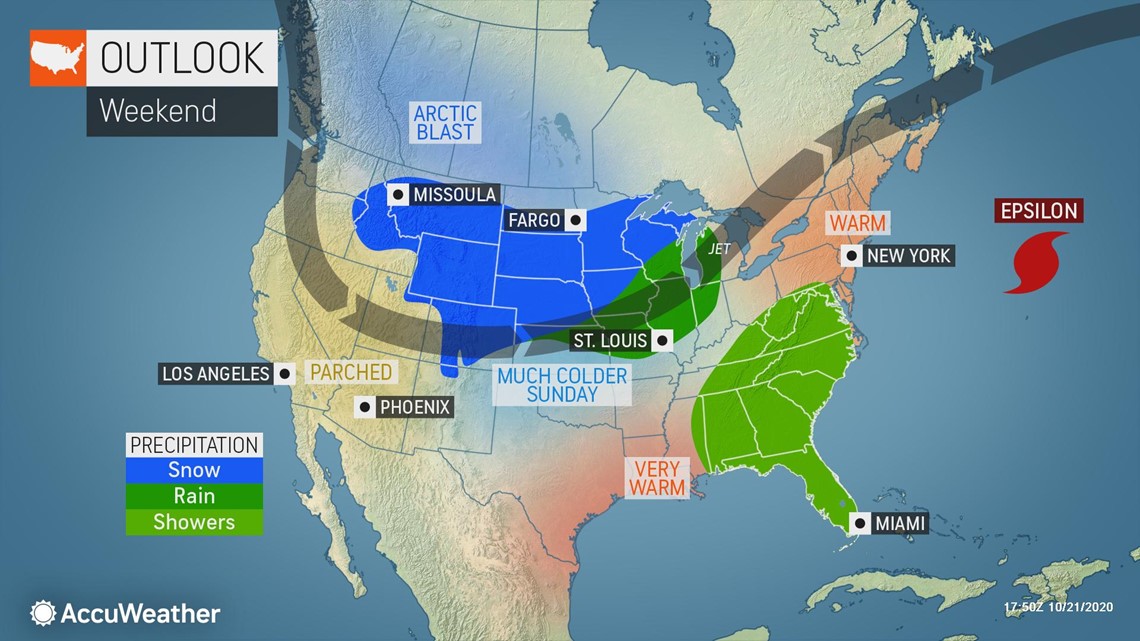
Even though there will still be no rain in California, this dip in the jet stream will bring much lower temperatures. For example, after a record-breaking number of 100-degree days in Phoenix this year, temperatures are unlikely to get out of the 70s by Monday and Tuesday. The last time that Phoenix failed to get out of the 70s was on April 13. The warmest locations in the region will also struggle to reach 80 degrees.
It is also not out of the question that the energy in the dip in the jet stream could produce some rain in Arizona. However, any rain is expected to be light and hardly beneficial.
The lower temperatures will be an aid to firefighters, but less wind and more precipitation are what the region desperately needs. While winds will relax by the middle part of next week, no significant precipitation is in store through at least the first week of November.